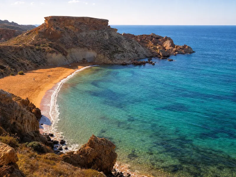
Fomm ir-Riħ is a wild, rocky bay on Malta’s west coast reached by a narrow cliff path and a short scramble to the beach. You now enter from a small car park by the cliffs, because the old vehicular route is no longer in use and access is disputed after one road was reportedly illegally blocked.
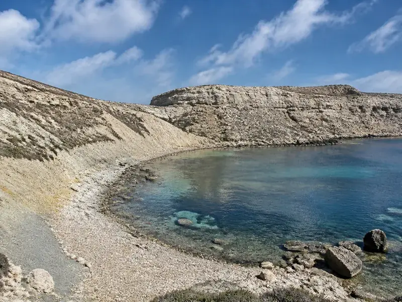
The draw is the setting, not convenience. Vertical cliffs close into a V around bright blue, crystal clear water, the pebble shore underfoot and a high, empty skyline above. The Maltese name means mouth of the wind, which tells you what you are walking into on a breezy day, and why the sea here can be wonderfully clean yet tricky when swell wraps into the bay. It suits confident hikers and swimmers who prize solitude, photographers chasing golden hour, and boaters on calm days. If you want deckchairs, a bar and an easy stroll, pick Golden Bay and Għajn Tuffieħa instead.
Surrounded by privately owned land, the small car park by the cliffs is the practical access point. GPS apps can be unhelpful here and may try to send you down blocked roads or onto private drives, so set for Baħrija first, then follow the downhill road towards the coast. From Rabat and Baħrija it is a winding drive towards the headland, dropping for roughly a couple of kilometres to the cliff edge. Parking is limited and the last stretch is a dirt pull‑off near the cliffs, so arrive early if you want a space.
From the car, the route is straightforward to describe and easy to get wrong in flip‑flops. The trail starts near the cliffs, then follows a narrow path cut into the slope before a stonier descent to the beach. The trail is steep, rocky, slippery and unmarked. Some steps are destroyed and you may need to climb. Expect uneven ground with loose rocks underfoot, take it slow, and save enough energy for the climb back up.
Plan your visit around light, heat and swell. Spring into early summer paints the headlands green and blooming, while winter and early spring days are the most comfortable for the hike. July and August are punishing at midday because there is no shade, so go at first light in summer, about 7am, or aim for sunset on cooler days. If you stay late, bring a flashlight or your phone light because the trail is tricky in the dark. The bay is a lovely sunset spot when the horizon clears, but keep an eye on wind and waves before you commit to the descent.
There are no services at the water. No beach bars, no buildings, no lifeguards and no sunbeds at the bay. Bring plenty of water and snacks, and wear hiking shoes, tennis shoes or hiking sandals. A mask is handy, but watch your entry because rocks are visible underwater and swell can rise without warning. The shore is rocky, so a light mat helps.
Getting there is part of the day out. Drive via Rabat and Baħrija, then descend towards the coast for the final stretch to the small car park. Do not rely on a shortcut offered by your phone, and do not attempt to drive past any barriers. Access is on foot from the car park via the cliff path and a short climb. Confident paddlers sometimes reach the bay by kayak when seas are calm, and boats occasionally anchor outside the swell line.
If you have time to explore after a swim, look up behind the beach. An unusual syncline lies just behind the beach, a reminder that this coast sits on a major fault line that lifted the cliffs into these dramatic walls. To the north the Ras il-Pellegrin headland carries faint cart ruts, the stone‑age grooves found across Malta. Cart ruts on Ras il-Pellegrin lead right off the cliff top, so give the edge more space than you think you need.
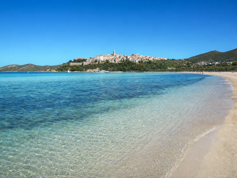
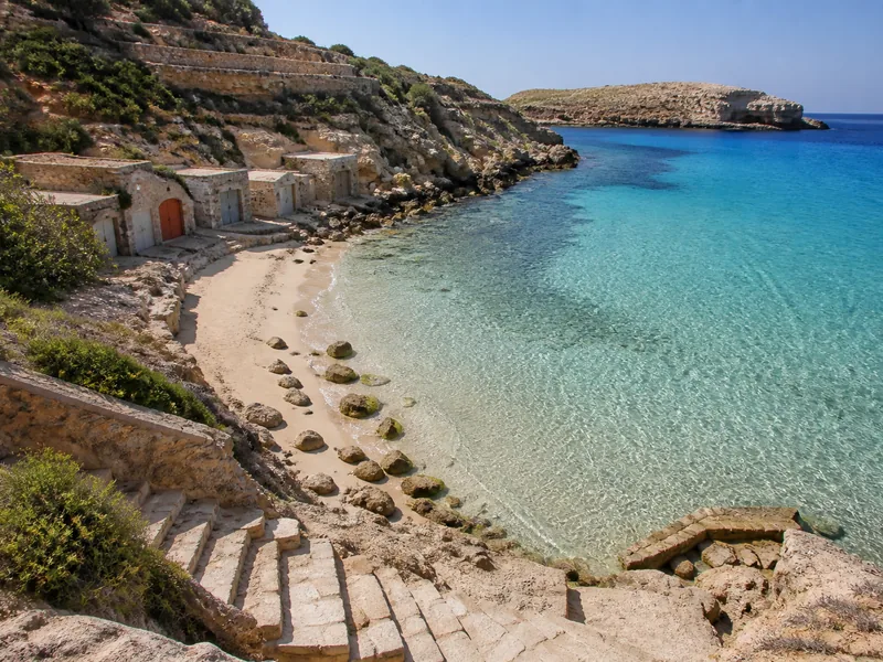
Timing and alternatives matter. For a sandy swim with cafés and lifeguards in season, head to Golden Bay and Għajn Tuffieħa, 2.93 km to Golden Bay and 2.44 km to Għajn Tuffieħa along the same coast, or to Mellieħa Bay for a long, shallow beach. Divers will be happier at Cirkewwa, while boat days to the Blue Lagoon, the Crystal Lagoon and the Santa Marija Caves scratch the clear‑water itch without the climb.
A simple step‑by‑step visit goes like this. Arrive early and park neatly without blocking the track. Pack water, sun protection and decent shoes. Walk to the cliff‑edge path, descend carefully, testing each step, and choose a stable rock for your bag well above the wash line. Swim within your limits, watch for boat wash, and keep an eye on wind picking up. If you wander, it is about a 15 minute walk from the beach to the large standing stone on the horizon, but the approach uses damaged steps and a bit of climbing, so treat it as a small scramble rather than a stroll. Start back up before the light goes.
Common mistakes are easy to avoid. People arrive expecting sand and a kiosk, then discover a rocky cove with nothing for sale. Others trust their GPS and end up at a dead end or a gate. Some come in beach slides, only to find the descent slow and scratchy. A few push too close to cliff edges for a photo, which is a bad idea on this fractured coastline. Access is disputed after one road was reportedly illegally blocked, and protests by the Ramblers Association highlighted the long‑running access problem, so treat the area with respect and stick to the established path and the shore.
Why go at all, given the effort. Because on a calm day the water can be the clearest you swim in on Malta’s main island, the headlands feel wild and empty, and sunset can light the cliffs like a stage. Go prepared, go early or late, and you will likely share the bay with only a handful of others, sometimes just a couple of kayakers and you.
Key notes in one place for planning. The bay sits within Mġarr’s limits on the western side of Malta. There is usually space if you are early, but parking is limited. There are no opening hours, just the sun and your legs. If you want an easy day, choose a serviced beach. If you want a wilder one, this is the place.
Common questions
Is the path suitable for children or buggies?
No. The trail is steep, rocky, slippery and unmarked, and some steps are destroyed and you may need to climb. It is not suitable for toddlers, strollers or mobility issues.
Can I reach the bay without hiking?
By land, no. Access is disputed after one road was reportedly illegally blocked, and the practical way in is the narrow cliff path from the small car park. Confident paddlers sometimes arrive by kayak when the sea is calm.
When is the best time to go?
Spring and early summer bring green cliffs and wildflowers, and September–October keep the sea warm. In summer start early, about 7am, or go for sunset and bring a light for the climb back.
Is there anywhere to buy food or rent umbrellas at the beach?
No. There are no beach bars, no buildings, no lifeguards and no sunbeds at the bay. Stock up in Baħrija or Mġarr before you drive down.
Last checked: 21 September 2026. Prices, opening hours and timetables change, verify anything time-sensitive before you travel. Photo: R Muscat, CC BY-SA 2.0.